
My name is Andrea Vaccari and I'm a Product Manager at Facebook. I currently lead several initiatives for Messenger, and I used to work on location products for our main app. Previously I was the Cofounder and CEO of Glancee, an app to meet people nearby with mutual friends and similar interests. Glancee was acquired by Facebook in 2012.
I studied C.S. at Politecnico di Milano in Italy and University of Illinois in Chicago. I did research at the Massachusetts Institute of Technology and the Santa Fe Institute. I interned at Google, working on internal tools for Maps. Some of my work has been exhibited at the MoMA in New York City and the Design Museum in Barcelona.

SMS in Messenger is a feature that allows people to use Messenger for Android to stay in touch with family, friends, and phone contacts over SMS. With SMS in Messenger, people can send and receive SMS messages in Messenger without having to switch between apps.
The feature started to roll out in June 2016, after a year-long effort to make this possible. We built it because we understand people talk both via SMS and via Messenger, and we wanted to make it easier for our users to stay on top of their conversations.
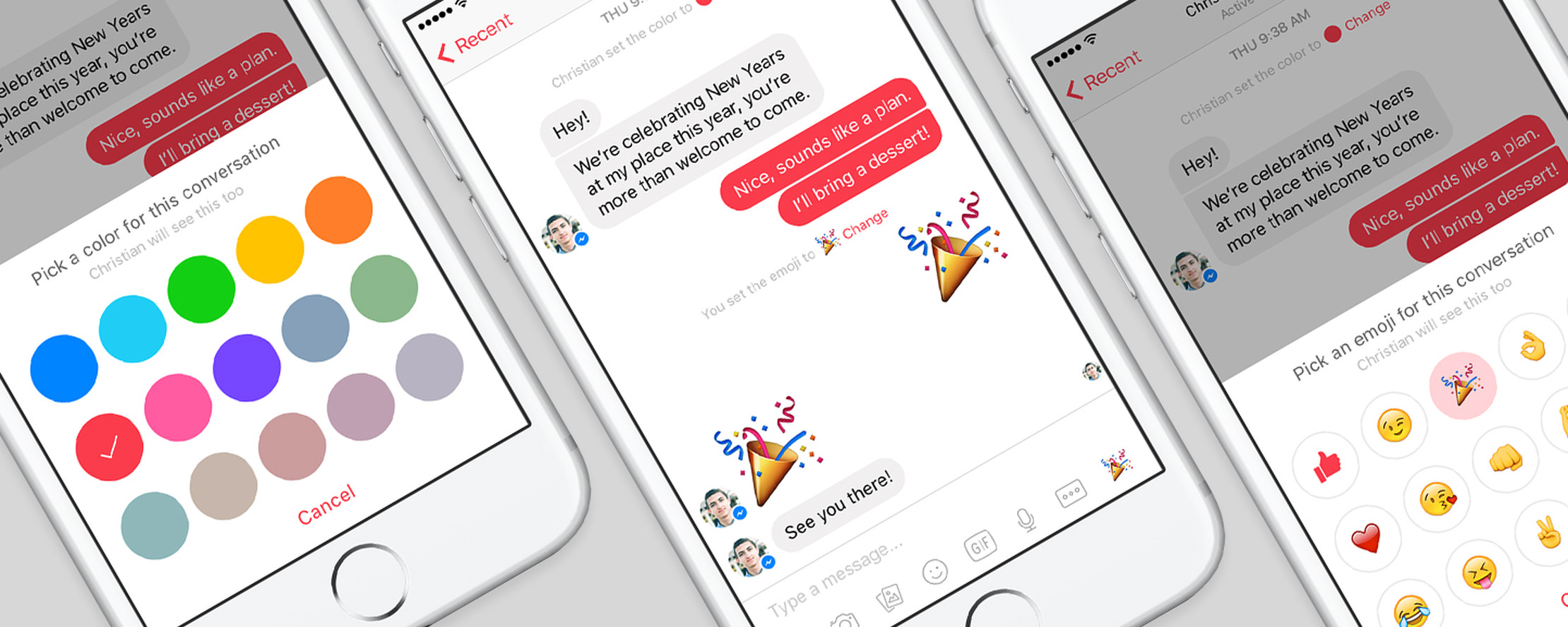
Messenger customizations are a group of features we released during the holidays in 2015 to allow our users to make their conversations more personal. People can now change the color of text bubbles, set a new emoji for the hot like button, and give each others nicknames.
We looked for simple ways to bring value and delight, and our users' response has been ovewhelmingly positive. People love making their Messenger unique with colors and emoji, and showing someone that they care about them with a cute or funny nickname.
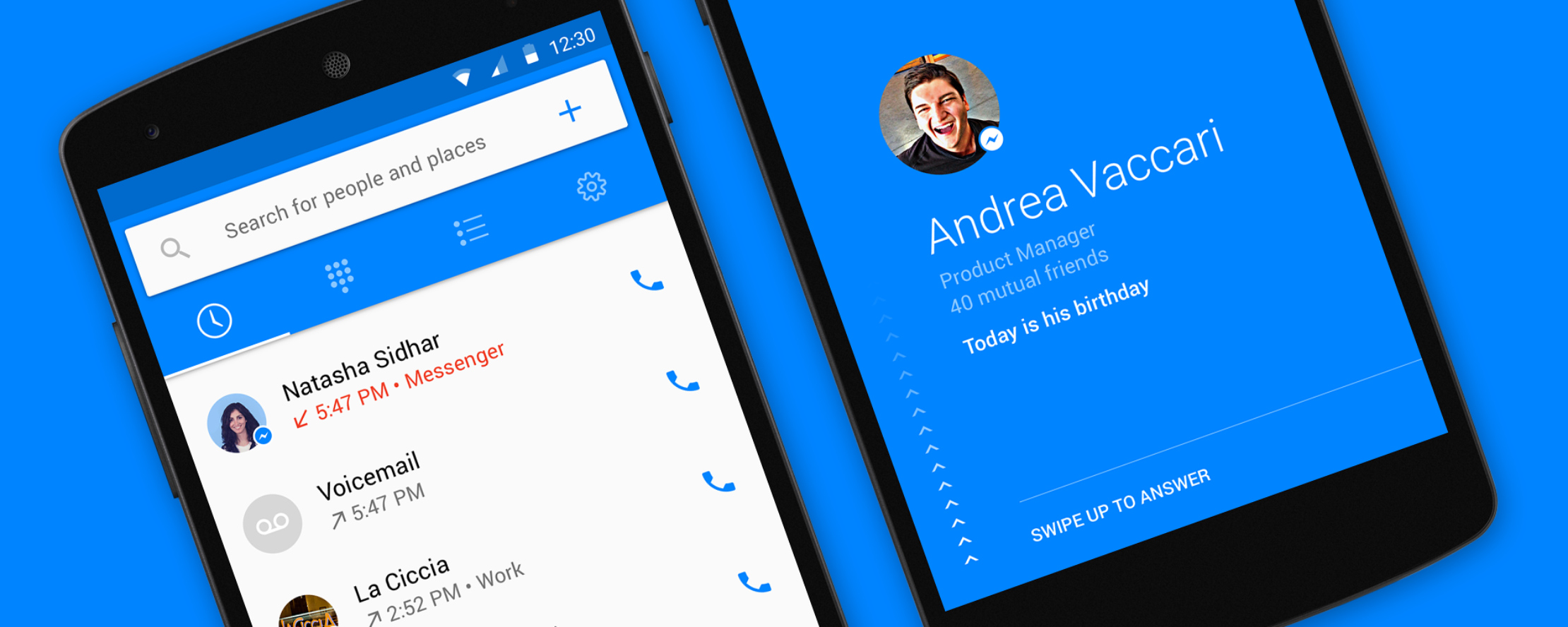
Hello by Messenger is a new app built just for Android that connects with Facebook to make your calling experience more useful and personal. With Hello, you can see who's calling, block unwanted calls, and search for people and places on Facebook.
Billions of calls are made every day around the world, yet the experience of calling hasn't improved in a long time. With Hello, we believe we have the opportunity to improve the way people communicate with family, friends, and businesses.

Nearby Friends is a new feature for Facebook that helps you discover which friends are nearby or on the go. When you turn on Nearby Friends, you’ll occasionally be notified when friends are nearby, so you can get in touch with them and spend more time together.
With Nearby Friends, you can also share your precise location with the friends you choose for a set period of time, such as the next hour. Your friends will see exactly where you are on a map, which helps you find each other and meet up.

Glancee is a location-based app that helps you discover the hidden connections you share with the people around you. Glancee highlights people who have friends in common with you, attend your school, work in your company, or simply share interests similar to yours.
You can use Glancee to explore the profiles of people in your area, or you can be notified when someone interesting is nearby. When you notice someone, message them and meet up for coffee. Create new, meaningful connections with people important to you.
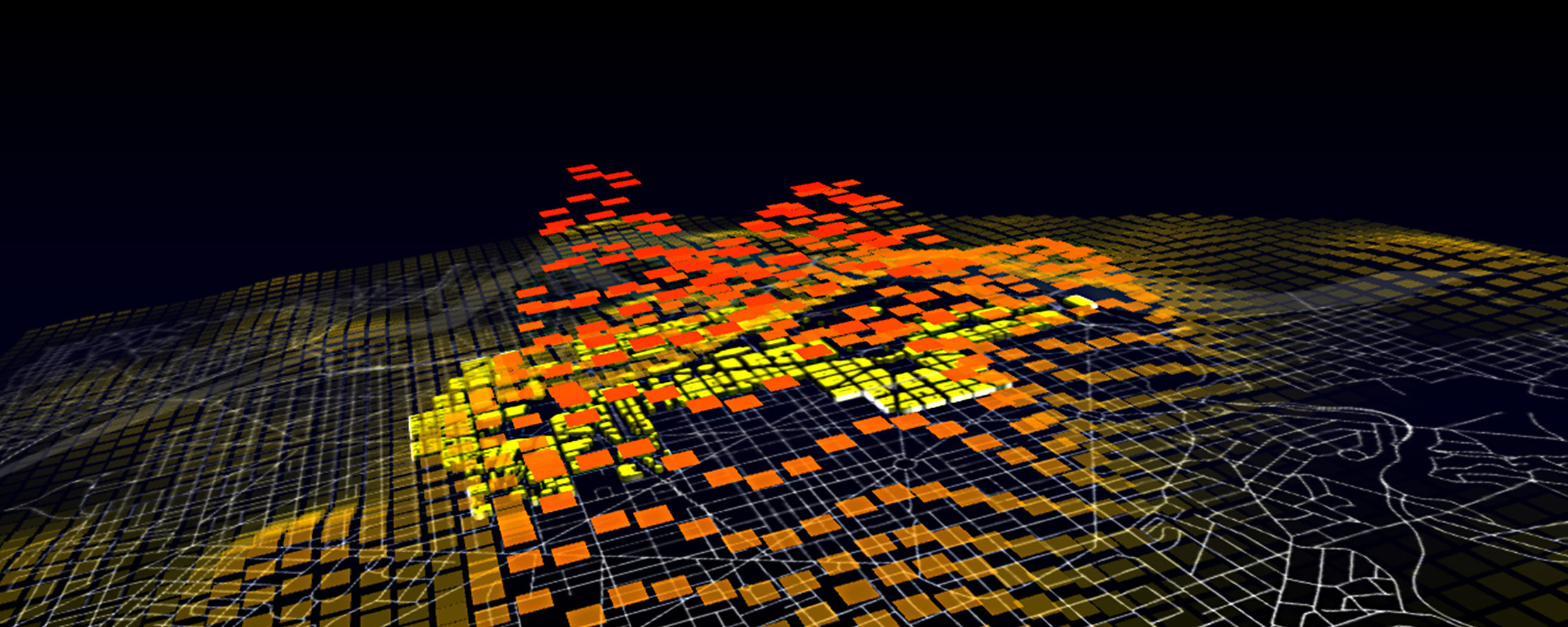
Obama | One People is a celebration of the President's first election. It is an analysis of the cell phone network activity in Washington, D.C. on January 20, 2009 to better understand the movements and reactions of the crowd that gathered in the capital for the occasion.
The results of these data analyses are presented in two visualizations that answer the questions: Who was in Washington, D.C. during Obama's Inauguration Day? When did they arrive, where did they go, and how long did they stay in the city?
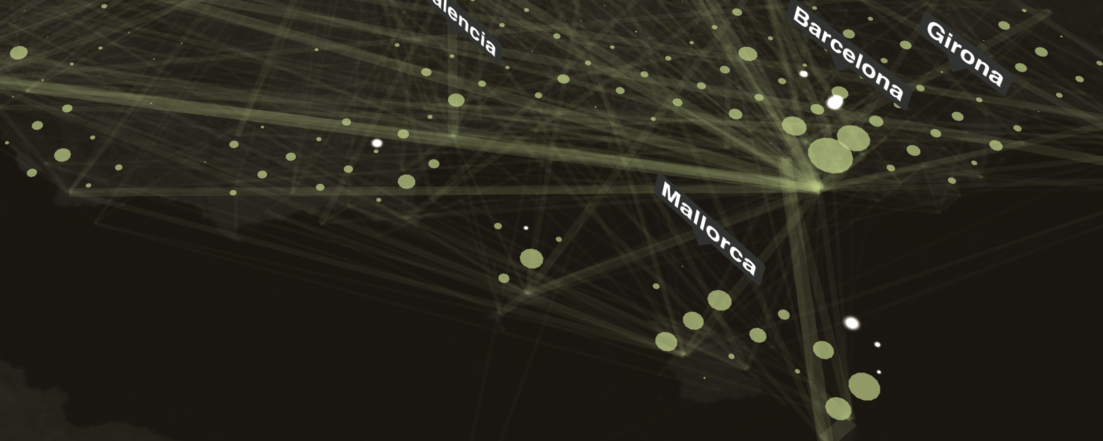
World's Eyes is a study of contemporary tourism in the region of the Iberian Peninsula. It is based on the analysis of geotagged photos taken in the area and uploaded to Flickr, which allowed to uncover the evolution of the presence and flows of tourists.
The analysis and mapping of this data was useful at multiple levels. It allowed to quantify the popularity of leisure cities and their points of interests, as well as characterize the type of activities and trails of visitors of different nationalities.
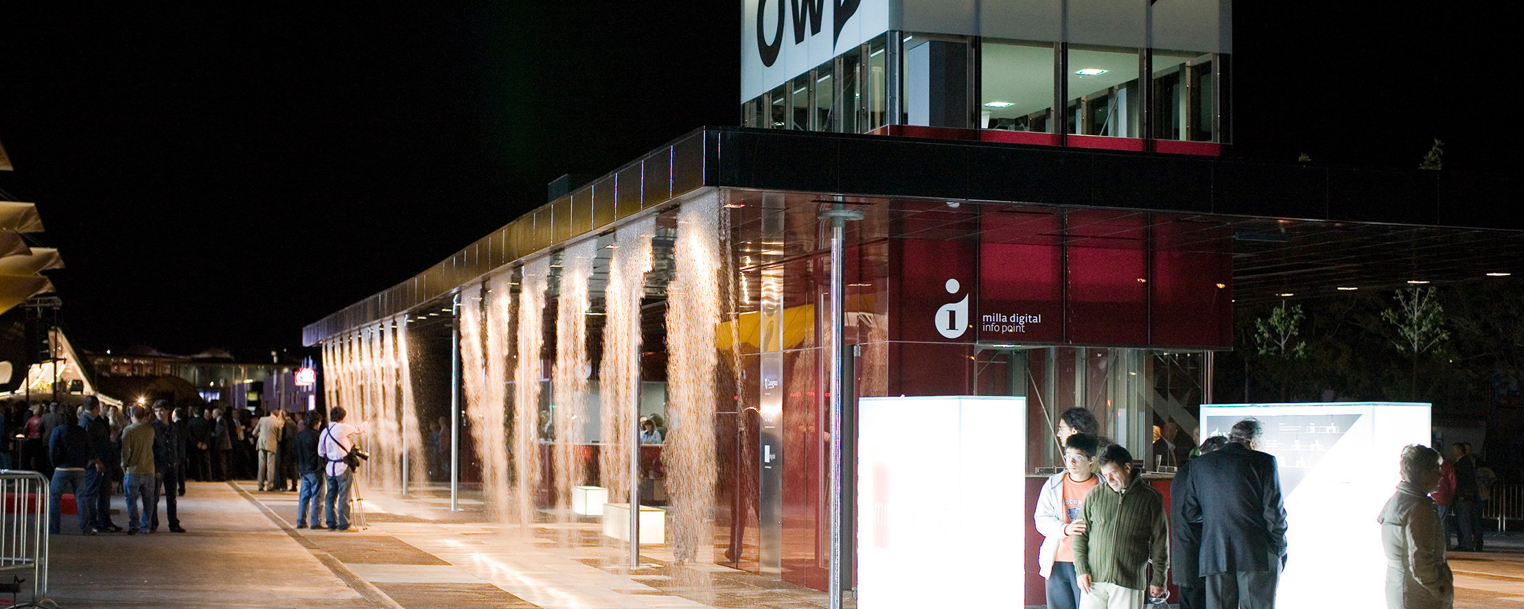
Digital Water Pavilion was an interactive structure made of digitally controlled water curtains that was built in occasion of the World Expo in Zaragoza, Spain in 2008, under the supervision of Prof. Carlo Ratti and Prof. William Mitchell of MIT.
The project is the first example of reconfigurable architecture that allows spaces to expand and shrink based on necessity and use. A real-time control system uses sensors to detect people and open passages, or to control the ceiling's height to avoid splashing.
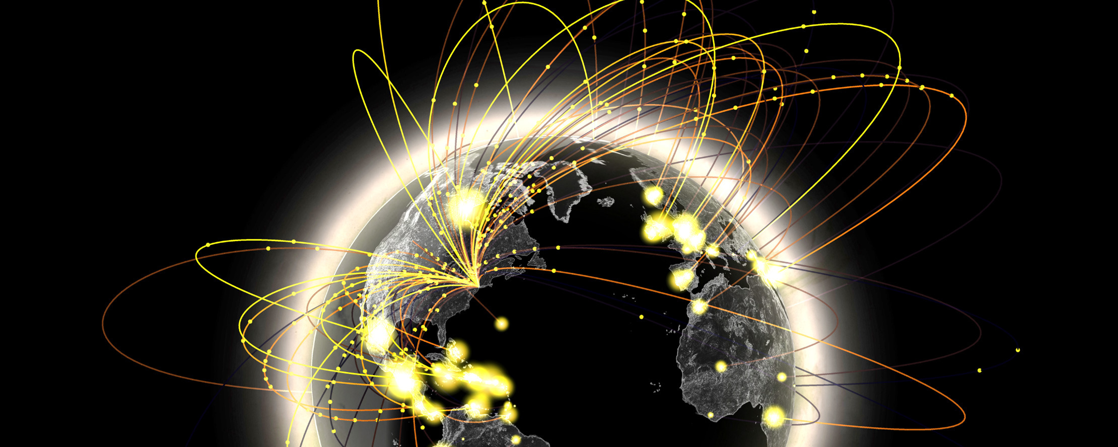
New York Talk Exchange illustrates the global flow of information by visualizing phone calls and Internet traffic between New York and other cities around the world. The project was exhibited at the Museum of Modern Art in New York for the Design and Elastic Mind exhibition.
NYTE uses large data sets of telecommunication logs at the scale of the local exchange. It reveals the relationships that New Yorkers entertain with the rest of the world, and shows how behavioral data can be used to better profile multiethnic neighborhoods.
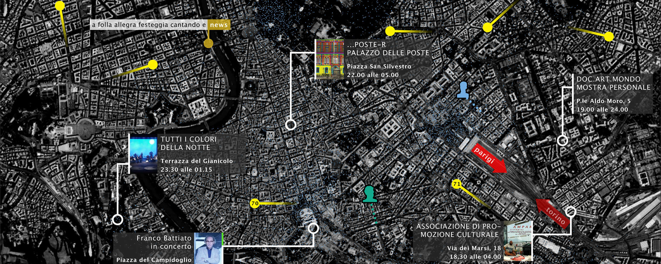
WikiCity Rome is a real-time interactive map built for the City of Rome in occasion of the Notte Bianca of 2007. It provides city dwellers with actionable insights about the people and public services around them. It is an illustration of the idea of the city as a real-time control system.
The map shows the estimated distribution of people based on cell phone network analysis. It also shows the position of busses and cabs, and updates by the journalists of La Repubblica, the major Italian newspaper, which are broadcasted live from the location of each event.